![[NOAA]](../img/noaa.gif) ![[ETL]](../img/etl.gif) |
|
|
Daily Nauru99 Report NOAA Ship RONALD H. BROWN Previous <- 6/25/99 -> Next
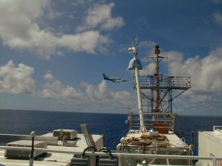
Time:1515 Local, 0315 Z Visual Observations:Steady wind has roughened the sea surface. Many puffy MBL cumuli, with occasional showers developing around the ship. Notable Events and Anecdotes:Many strong T-storms were observed visually and by radar to the SE last night, advecting towards ship but dissipating as they approached. RHB has remained within 200 m of the buoy all day due to cooperating wind. Last night at sunset the fisherman made a big catch. Cessna overflights continue, twice per day. Instrument Status:: C-band radar is repaired and running well again. The column water vapor discrepancy between sondes and the microwave radiometer has been resolved by adjustments to MWR processing parameters. |
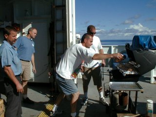
Fisherman prepare their Mahi Mahi catch for all hands. Captain Parsons (second from left) observes with keen interest.
|
| NOAA |
ETL |
Nauru 99 |
Webmaster Updated: June 1999 |
|