![[NOAA]](../img/noaa.gif) ![[ETL]](../img/etl.gif) |
|
|
Daily Nauru99 Report NOAA Ship RONALD H. BROWN Previous <-7/1/99 -> Next
Time:1545 Local, 0345 Z
Visual Observations:Another fair day with moderate breezes, popcorn cumuli, and a few whitecaps. Notable Events and Anecdotes:We arrived at RHB's "small triangle" location at about 0915 this morning (local time), 2115 on 30 June GMT. Nauru Island is clearly visible about 10 miles away, rising 200 feet from the sea. With binoculars we see buildings, roads, and ships. ARCS2 staff on the island can see only the ship's large round radome, affectionately called Neptune's Doorknob, due to the earth's curvature. HF communications are solid with Nauru, but VHF does not work at all. We both have concerns about communicating with Mirai on any frequency tonight; they are 50 km from both of us, a distance bad for both line of sight and ionospheric skip. The weather is not cooperating (i.e., not producing good storms for dual Doppler observations, our primary goal for the small triangle configuration). No RHIB runs to Nauru today, but they will begin tomorrow. A New Zealand film crew will come aboard and live with us for one day, starting tomorrow. Instrument Status:No changes. All is well. |
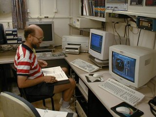
Hans Verlinde of Penn State University working on the C-band radar's remote display and control computers deep in the bowels of the ship, far from the radar itself. Hans will be working with Mirai and Nauru to identify storm cells for study, and to direct the Cessna 404. |
| NOAA |
ETL |
Nauru 99 |
Webmaster Updated: June 1999 |
|