![[NOAA]](../img/noaa.gif) ![[ETL]](../img/etl.gif) |
|
|
Daily Nauru99 Report NOAA Ship RONALD H. BROWN Previous <- 6/30/99 -> Next
Time:1500 Local, 0300 Z
Visual Observations:Another beautiful day without much scenery. A few showers on appear on horizon, but otherwise we see only ubiquitous, small cumuli and occasional whitecaps. Notable Events and Anecdotes:The Cessna made its last fly-bys today for our "large traingle" configuration. Just after sunset we plan to say good-bye to our friendly buoy and dolphins, and steam to RHB's "small triangle" position 20 km SW of Nauru. There has been a flurry of activity in association with tomorrow's RHIB run to Nauru, to occur just after we reach the small triangle position (ETA 0930 local time, 1 July). Instrument Status:All is well. It was another good radiometer and photometer day. |
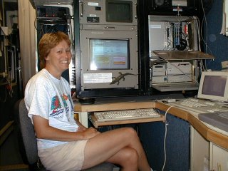
Ann Weickmann at work inside the HRDL lidar van, figuring out how to use all those bits from the C-band radar's inertial navigation unit to stabilize the lidar's scanner. |
| NOAA |
ETL |
Nauru 99 |
Webmaster Updated: June 1999 |
|