![[NOAA]](../img/noaa.gif) ![[ETL]](../img/etl.gif) |
|
|
Daily Nauru99 Report NOAA Ship RONALD H. BROWN Previous <- 7/3/99 -> Next
Time:1515 Local, 0315 Z
Visual Observations:Yet another fair-weather day, moderate breezes, no storms. Notable Events and Anecdotes:: At 0930 local time RHB left its Nauru station and steamed to Mirai for intercomparisons, reaching it at about 1145. We positioned ourselves about 0.9 km away and turned off our 915 MHz wind profiler, then exchanged visitors until 1700. On RHB, the science party selected its visiting contingent by lottery. Mirai is a beautiful and capable ship, and its highly professional crew and science staff were extremely good hosts. The two ships exchanged data and images from internal web pages. RHB left Mirai at 1730, bound for our former location 12 nm from Nauru. Tomorrow we will steam to within 500 meters of the island coast, adjacent to ARCS2. Instrument Status:Often cloud radar does not report clouds when other instruments do only because its archived readout is not immediately available to the individual who gathers data for the daily report. If clouds are not apparent on the instantaneous cloud radar screen, n/a is entered for the cloud radar input to the daily report. |
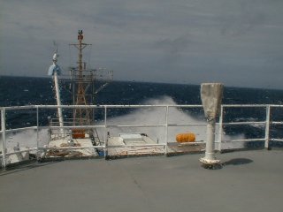
When seas are moderate to rough and RHB is underway, we often encounter bow spray, which blows backwards and wets instruments and people alike, as high as the bridge. |
| NOAA |
ETL |
Nauru 99 |
Webmaster Updated: June 1999 |
|