![[NOAA]](../img/noaa.gif) ![[ETL]](../img/etl.gif) |
|
|
Daily Nauru99 Report NOAA Ship RONALD H. BROWN Previous <- 7/11/99 -> Next
Time:1445 Local, 0245 Z
Visual Observations:Diffuse sunlight all day today because of cirrus, plus scatterred lower clouds. Wind is moderate. No whitecaps. Notable Events and Anecdotes:We completed 11 circumnavigations of the island in 23.8 hours at 8:30 this morning; all circuits except one (3 km distant) were at 1 km from the coast. Chlorophyl samples taken en route indicate increased chlorophyl productivity in the water below the cloud of phosphate from dockside loading operations. Chuck Pavloski and ship's engineers Mike Gowan and Pat McManus visited the ARCS site to fix sun photometers and air conditioners; both efforts were successful. The ship will hold position 2 km offshore on the windward side of the island until tomorrow morning; then we plan to move to characterize the gradient of the island's aerosol plume downwind from Nauru, provided phosphate loading has ceased. Mystery of the day: Will Jeff Otten's luggage appear at midnight? (The reverse Cinderella effect) Instrument Status:All is well. |
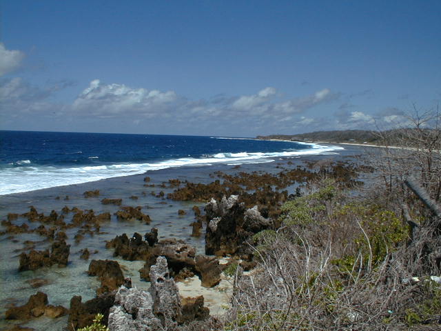
View of the SE Nauru coast at low tide from the Menen Hotel, where many Nauru99 workers and visitors reside. Swimming and snorkling generally is not safe because of rip tides and jagged coral spires. |
| NOAA |
ETL |
Nauru 99 |
Webmaster Updated: June 1999 |
|