![[NOAA]](../img/noaa.gif) ![[ETL]](../img/etl.gif) |
|
|
Daily Nauru99 Report NOAA Ship RONALD H. BROWN Previous <- 7/10/99 -> Next
Time:1510 Local, 0310 Z Visual Observations: Fair weather day until mid afternoon, when column water vapor rose markedly and moderately small storms began propagating across the Nauru region east to west. Notable Events and Anecdotes: Today at 9 a.m. we began repetive circumnavigations of the island 1 km from the coast. A phosphate ship was being loaded, with a large cloud of phospjhate dust trailing leeward. Lidars are taking data continuously to better characterize the effect of the island on the atmosphere. Chuck Long and Meegan from the ARCS site boarded RHB at 11:30, Chuck to confer on the next days' operations, Meegan to help Jen and Tepora with chlorophyl samples. We are running the SeaBeam ocean floor contouring sounder and getting nice 3-D images of the sloping shelf beneath the ship. Instrument Status: All is well. It appears, after comparing four island and ship sondes launched from opposite sites, that island sondes are biased dry. |
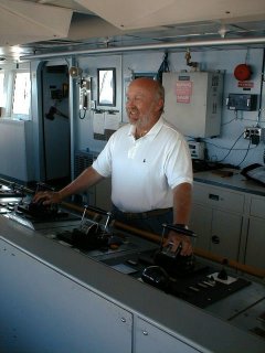
Tom Gillman, onboard RHB under NOAA's Teacher at Sea Program, re-enacting his dreams on the bridge of RHB. Tom, a former NOAA Corps officer, has organized the ship's Nauru99 internal web page and collects data for the daily reports. |
| NOAA |
ETL |
Nauru 99 |
Webmaster Updated: June 1999 |
|