![[NOAA]](../img/noaa.gif) ![[ETL]](../img/etl.gif) |
|
|
Daily Nauru99 Report NOAA Ship RONALD H. BROWN Previous <- 6/18/99 -> Next
Time: 1520 Local, 0520 Z Notable Events and Anecdotes: Attempted HF radio communications with Mirai for first time, without success. More scientists feeling sea sick today. Passage through Torres Strait during the night was uneventful. High winds and moderate currents are impeding our progress towards Nauru and Mirai. Instrument Status: DIAL laser chiller turned off today but was successfully reset. |
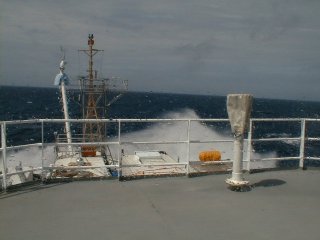
View of bow from the bridge showing bow spray that often falls onto forward instruments. Waves were estimated to be 2-3 meters in height. |
| NOAA |
ETL |
Nauru 99 |
Webmaster Updated: 18 June 1999 |
|