![[NOAA]](../img/noaa.gif) ![[ETL]](../img/etl.gif) |
|
|
Daily Nauru99 Report NOAA Ship RONALD H. BROWN Previous <- 06/19/99 -> Next
Time: 1605 Local, 0505 Z Notable Events and Anecdotes: Advanced ship time by 1 hour at 1500 ship time. We are now UTC plus 11 hours. Attempted HF radio communication with Mirai and Nauru yesterday at 0600 Z. RHB heard Mirai and Nauru heard RHB, but no 2-way contact. We all will try again today. Instrument Status: No change. Many remain covered because of wet conditions. |
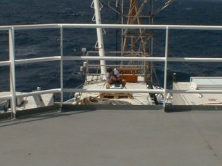
Chuck Pavloski of PSU on top of PMEL's Aerosol Van on 02 deck forward attending to Total Sky Imager. |
| NOAA |
ETL |
Nauru 99 |
Webmaster Updated: 19 June 1999 |
|