![[NOAA]](../img/noaa.gif) ![[ETL]](../img/etl.gif) |
|
|
Daily Nauru99 Report NOAA Ship RONALD H. BROWN Previous <- 06/20/99 -> Next
Time: 1510 Local, 0410 Z Notable Events and Anecdotes: Today RHB moved from the Coral Sea to the Solomon Sea via the Jomard Passage. With sheltered waters and a trailing wind, the ride became noticeably smoother. Tropical lagoons, long beaches and palm trees tempted a few scientists to consider jumping ship! Yesterday better HF radio communications were established with Mirai and Nauru: RHB heard Mirai, Nauru heard RHB and passed messages to Mirai. We saw several ships today, including a huge tanker, a sport fishing vessel, and a wreck (on a reef). Instrument Status: C-band radar locked up in vertical direction and was turned off. We await diagnostics and advice from U.S. before attempting to reconfigurae and restart. We discovered that our helium supply (for radiosonde balloons) is lower than thought because only 18 cylinders were filled in Darwin, not 24 as expected. This may cause rationing of radiosonde flights. |
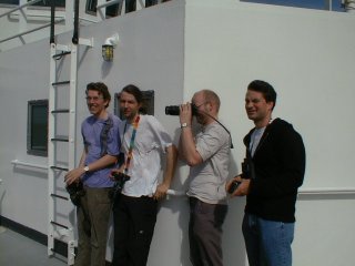
From left to right, Klaus Ertel, Volker Matthias, and Friedhelm Jansen of Max Planck Institute (MPI), and Volker Wulfmeyer of NCAR. All are enjoying a ray of sunlight and nice views of islands and lagoons in the Jomard Passage. |
| NOAA |
ETL |
Nauru 99 |
Webmaster Updated: 20 June 1999 |
|