![[NOAA]](../img/noaa.gif) ![[ETL]](../img/etl.gif) |
|
|
Daily Nauru99 Report NOAA Ship RONALD H. BROWN Previous <- 06/22/99 -> Next
Time: 1500 Local, 0300 Z Visual Observations: Glassy seas (no wind). Beautiful weather with small MBL cumuli and higher patchy cirrus. Notable Events and Anecdotes: We saw our last land for 8 days about noon today en route to the TAO buoy nominally at 2 S, 165 E (but actually at 1 - 55.8 S, 164 - 23.4 E). Many flying fish were seen today, prompting the ship to cast out trolling lines. Last night's attempts at HF radio communications were marginally successful with Mirai, unsuccessful with Nauru. We may try different times and/or frequencies tonight. Everyone's spirits seem to be soaring as we approach the first mission milestone with sensors in good shape, stomachs settled, and glorious weather. Instrument Status: C-band radar is operating again after repairing the coupling between pedastal drive motors and az-el gear boxes. We set up a VHF aircraft radio (high wattage base unit) on the bridge in preparation for Cessna flights tomorrow when we arrive at the buoy, ETA 0500 Z (1700 local time). |
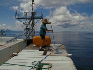
Scott Sandberg of NOAA/ETL washing dirt off the top of the HRDL lidar van, to lighten solar heat loading and to tidy the scene for a possible DOE film crew visit in early July. |
| NOAA |
ETL |
Nauru 99 |
Webmaster Updated: 22 June 1999 |
|