![[NOAA]](../img/noaa.gif) ![[ETL]](../img/etl.gif) |
|
|
Daily Nauru99 Report NOAA Ship RONALD H. BROWN Previous <- 7/9/99 -> Next
Time:1515 Local, 0315 Z
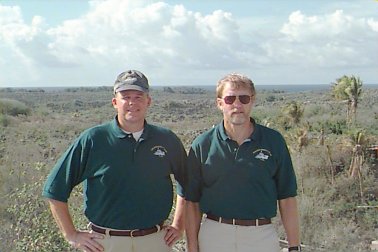
Visual Observations:A more typical day: mostly sunshine with scattered MBL cumuli but with a few higher clouds. Brisk wind and whitecaps Notable Events and Anecdotes:After yesterday's rains and clouds we decided to stay put for another 24 hours to get better radiative measurements on the windward side of the island. Seas remain rough so RHIB runs to Nauru are being kept to a minimum. Jeff Otten arrived onboard this morning, glad to be here. The ship has made enough fresh water to allow laundry again; there was a rush to the machines because most of us were out of clean skivies! Jeff Hare and Jon Shannahoff observed ARCS radiosonde launch procedures to help understand an apparent dry bias in sondes there. Four island sondes have now been launched from RHB and vice versa, but results are not yet in. Instrument Status:All is well on the western front. |
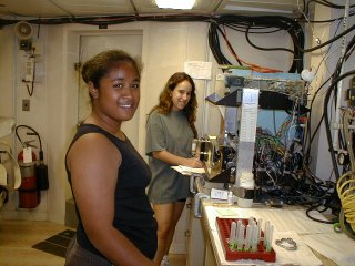
Tepora Toliniu (student) and Jennifer Aicher (teacher) of La Vai Moana Marine Center in American Samoa, working in the Hydro Lab. Jen also helps with ballon launches and Tepora with hand-held sun photometer observations.
|
| NOAA |
ETL |
Nauru 99 |
Webmaster Updated: June 1999 |
|