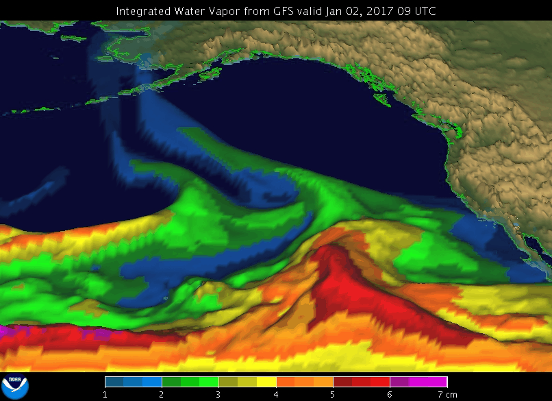
Animation of an AR event in January 2017 (Credit: NOAA Physical Sciences Laboratory)
Animation of an AR event in January 2017 (Credit: NOAA Physical Sciences Laboratory)
Atmospheric Rivers (ARs) are relatively narrow regions
in the atmosphere and are responsible for most of the horizontal transport of
water vapor outside of the tropics. While ARs come in many shapes and sizes,
those that contain the largest amounts of water vapor, the strongest winds,
and stall over watersheds vulnerable to flooding, can create extreme rainfall
and floods. These events can disrupt travel, induce mud slides, and cause
catastrophic damage to life and property. However, not all ARs cause damage –
most are weak, and simply provide beneficial rain or snow that is crucial to
water supply.
Improved monitoring, observation-based process understanding and
prediction of ARs provide the critical knowledge needed by flood control
managers, water supply authorities, and reservoir operators to mitigate the
risks of major flood events while being able to take advantage of these heavy
rainfall events as drought busters.
NOAA and its partners conduct targeted field campaigns using satellite
measurements, offshore aircraft reconnaissance, and land-based AR
observatories to guide model forecast system development, leading to
improvements in the prediction of AR intensity and duration to support water
resource management decisions.