MISR & CLOUD RADAR CLOUD HEIGHTS COMPARISON
OVER THE NORTH SLOPE OF ALASKA ARM SITE
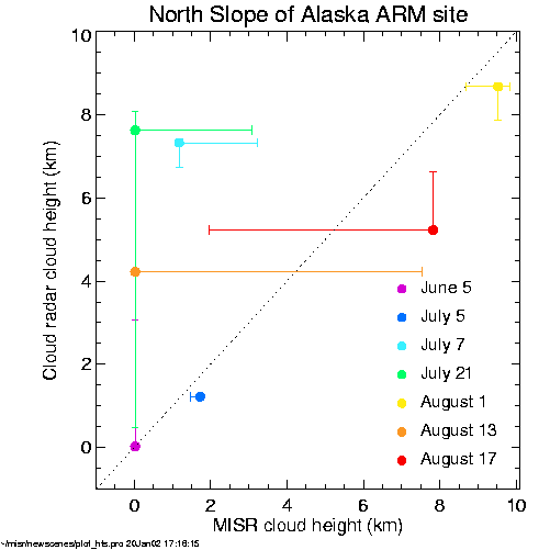
While the most probable values for the two respective cloud heights don't always closely agree, for six of the seven cases, the MISR and cloud radar cloud heights occur within each other's 10% to 90% quartile ranges. This general agreement is subjectively supported by the larger-scale spatial (MISR) and temporal (cloud radar) variability seen in their respective data. The one case that shows clear disagreement occurs on July 7. On this day, the cloud radar detected three separate broken cloud layers. Large changes in the top cloud height occurred throughout the day. It is difficult for MISR to perform a robust stereo reference in such a situation. |
|