FIRE WEATHER OBSERVATORIES
Improving Monitoring in Complex Terrain
Photo by Robert Hyatt, NOAA/NWS
Recognizing the increasing threats of wildfire and its potential negative impact on communities, the FY22 Bipartisan Infrastructure Law (BIL) Provision 15 provided funding for “observation and dissemination of infrastructure used for wildfire prediction, detection, and forecasting.” In addition to several other fire weather initiatives, NOAA Research is using funding from the BIL to help fill the fire weather observation gap specifically in complex terrain where weather is more unpredictable. This in turn can make forecasting more difficult.
About this project
NOAA's Global Systems Laboratory (GSL), Global Monitoring Laboratory (GML), Air Resources Laboratory (ARL), and Physical Sciences Laboratory (PSL), have partnered to build four fixed boundary layer observation facilities and two mobile units equipped with similar instruments.
These facilities will better characterize the fire weather environment and help to conduct research on the physical processes that contribute to adverse fire weather conditions in complex terrain.
About the fixed sites
Four fixed observing sites will be created in the intermountain western United States.These sites will each be instrumented with:
| Instrument | What it provides |
|---|---|
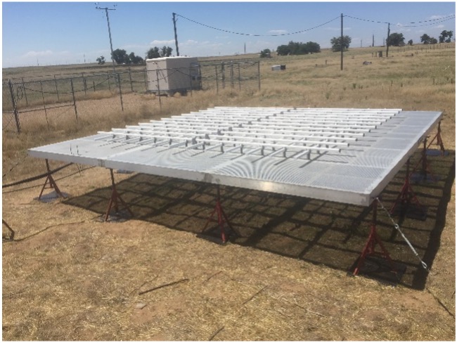
| 449-MHz Doppler radar wind profiler | Profiles of wind speed and direction from about 100 m to over 4 km |
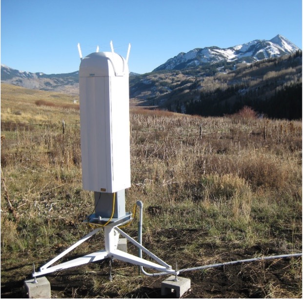
| Infrared spectrometer | Profiles of temperature and humidity from the surface to 3 km; cloud properties |
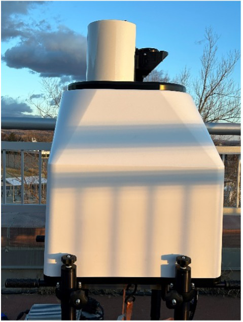
| Polarization sensitive ceilometer | Measurements of height of aerosol and cloud layers, and the ability to discriminate between the two |
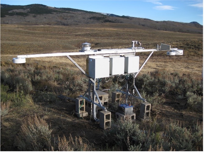
| Surface radiation measurement equipment | Measurements of downwelling and upwelling radiation in both longwave and shortwave bands; Helps understand cloud and aeosol impacts |
| Fast-response sonic anemometers and moisture probes | Measurements of surface turbulent fluxes of heat, water vapor, and momentum |
| Standard surface meteorology sensors | Near-surface measurements of temperature, relative humidity, atmospheric pressure, precipitation amount, and wind speed and direction |
| Soil moisture profile probes | Soil moisture profiles for understanding the linkages between atmospheric conditions and the evolution of soil properties |
| Trace gas/aerosol concentration detectors | Trace gas/aerosol concentration measurements including particulate matter concentrations at two sizes (2.5 µm and 10 µm) and carbon dioxide and carbon monoxide concentrations. |
About the mobile facilities
Two mobile observing units — called Collaborative Lower Atmospheric Mobile Profiling Systems (CLAMPS) - will be built. Each CLAMPS will have instrumentation similar to that listed above for the fixed sites, except that the large Doppler radar wind profiler is replaced by a much more compact wind profiling Doppler lidar for this application.
Instrumentation for the mobile facilities will be transported in a trailer pulled by a pickup truck. Some of the instruments will be set up outside of the trailer during deployments.
These mobile facilities will be used to monitor atmospheric and terrestrial conditions closer to the fires (natural or prescribed) and can be used, for example, to simultaneously monitor conditions upwind and downwind of active wildfires. They also will augment the fixed sites by providing complementary information around those sites.
About the Uncrewed Aircraft Systems
In addition to the above observing facilities, an Uncrewed Aircraft Systems (UAS) capability is being developed that will allow for low-altitude measurements of standard meteorological parameters (wind speed and direction, temperature, humidity and pressure), as well as turbulent fluxes.
UAS will also be used for trace gas studies, aerosol concentrations, and surface characterizations such as albedo and fire front location among others.
The UAS could be deployed in conjunction with the mobile facilities, as well as independently if the mobile facilities are unavailable and/or for other applications.
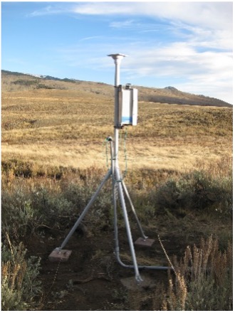
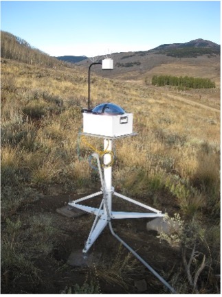
Measurement tool examples
Photos by NOAA Physical Sciences Laboratory and Global Monitoring Laboratory. Meteorology Tower photo by Air Resources Laboratory.
Why is this project necessary?
Wildland fire is an increasing threat and a year-round occurrence in many areas of the U.S., especially the high plains and Western states, including Alaska. In recent years, the impact of wildfires has increased substantially. Records have been set in the past several years for the number of acres burned nationwide (2020), how much was spent on wildfire fighting in a year (2021), and the cost of damage caused by wildfires (2021), even in the West alone.
The dangers associated with wildfire have prompted the National Weather Service to issue red flag warnings on days when the forecast calls for warm temperatures, low humidity, dried fuels (trees, brush, grasses) and strong winds.
The wind near the surface can change rapidly as the daytime boundary layer grows and mixes down stronger winds from aloft. In addition, the complex terrain in mountainous states creates diurnal mountain-valley circulations and downslope windstorms. These areas of the country also lack sufficient observations to make informed decisions about fire weather.
What is the goal?
The data gathered from the fixed sites and mobile units will help better understand the weather dynamics in areas that are known to have a high risk of wildfires that can be greatly affected by constant changes in wind and other factors. These new observations can help NOAA better ascertain wildfire behavior in complex areas. This can lead to improvements in wildfire forecasting and understanding, and through NOAA Research’s data assimilation and model development work, improved numerical weather prediction models run by the National Weather Service.
How will the data be shared?
As much data as possible from the fixed sites, mobile facilities, and UAS will be communicated in near real-time back to data hub(s) in the David Skaggs Research Center in Boulder, Colorado.
These data will be displayed online to monitor instrument health and to share the observations publicly with fire weather forecasters, firefighters, researchers, and other interested parties. Other datasets that require post processing will be made publicly available at the appropriate time.
All datasets will be archived for future public use and to support research objectives.
This page will be updated as the project progresses and links to the datasets provided here.
