Unprecedented effort launched to discover how El Niño affects weather

Adapted from a NOAA.gov news release
NOAA scientists and partners have embarked on a land, sea, and air campaign in the tropical Pacific to study the current El Niño and gather data in an effort to improve weather forecasts thousands of miles away.
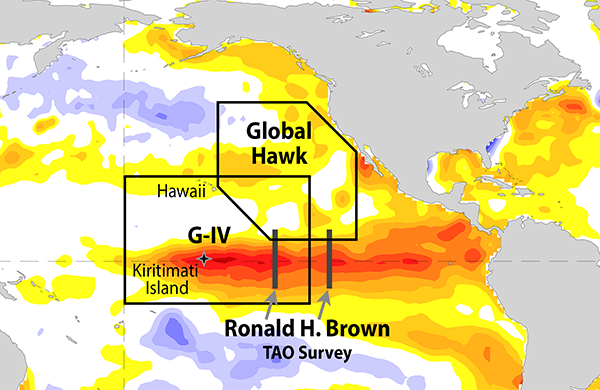
The El Niño Rapid Response (ENRR) field campaign will deploy NOAA's Gulfstream IV research plane and NOAA Ship Ronald H. Brown, NASA's Global Hawk unmanned aircraft equipped with specialized sensors, and researchers stationed on Kiritimati (Christmas) Island in the Republic of Kiribati, approximately 1,340 miles south of Honolulu. Together, scientists will collect atmospheric data from this vast and remote expanse of the tropical Pacific where El Niño-driven weather systems are spawned.
"The rapid response field campaign will give us an unprecedented look at how the warm ocean is influencing the atmosphere at the heart of this very strong El Niño," said Craig McLean, assistant NOAA administrator for NOAA Research. "This research will help us understand the first link in the chain that produces, among many other weather impacts, extreme precipitation events on the West Coast."
El Niño is a recurring climate phenomenon, characterized by unusually warm ocean temperatures in the equatorial Pacific, that increases the odds for warm and dry winters across the northern United States and cool, wet winters across the south. El Niño is the warm phase of the ocean cycle known as El Niño-Southern Oscillation, or ENSO for short. La Niña is the cool phase. The pattern can shift back and forth every two to seven years, disrupting weather patterns across the globe.
During the two strongest El Niños before this, California has been soaked by intense rainstorms causing flooding, landslides and other property damage. NOAA scientists say this event is among the strongest El Niños on record, comparable to the last major event in 1997-98. How much precipitation this El Niño will deliver to California is a subject of intense interest to a region struggling to manage the effects of an historic drought.
NOAA researchers anticipate that the data gathered by weather balloons and instruments dropped from aircraft will help improve the models that are used to support weather forecasts. The data will also provide insights that researchers hope will improve year-to-year ENSO forecasts, as well as the accuracy of models predicting longer-term effects of climate change.
"This has never been done with a major El Niño," said Randall Dole, a senior scientist with NOAA/ESRL's Physical Sciences Division (PSD) in Boulder, Colorado. "A field campaign ordinarily takes years to plan and execute. But we recognized what an important opportunity we had and everyone worked hard to pull this mission together."
NOAA and partner assets deployed to support the El Niño Rapid Response Field Campaign include:

NOAA's Gulfstream IV (G-IV) aircraft is flying out of Honolulu International Airport carrying a suite of meteorological sensors on an estimated 20 research flights in the central Pacific from late January to early March. The G-IV will be dropping weather instrumentation and using Doppler radar located in the aircraft’s tail to gather weather data.
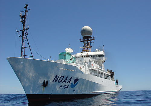
NOAA Ship Ronald H. Brown will launch weather balloons up to eight times a day during the Tropical Atmosphere Ocean (TAO) survey cruise in the eastern tropical Pacific. The ship will depart Honolulu on Feb. 16 and arrive in port in San Diego on March 18.
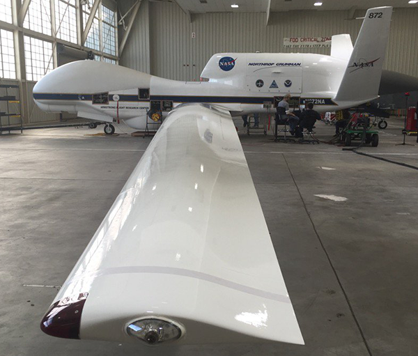
NASA's Global Hawk unmanned aircraft will carry a suite of meteorological sensors and drop parachuted weather instruments during four research flights in February in the eastern Pacific, near the U.S. West Coast. The Global Hawk is a key asset for the SHOUT project led by the NOAA UAS Program.
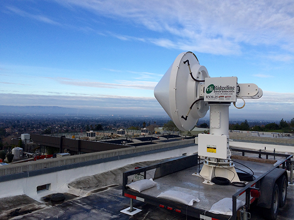
Scanning X-Band Radar has been temporarily installed in the south San Francisco Bay to fill coverage gaps in the existing radar array and provide more accurate rainfall estimates for the region to better manage potential heavy precipitation and associated negative impacts from El Niño storms.
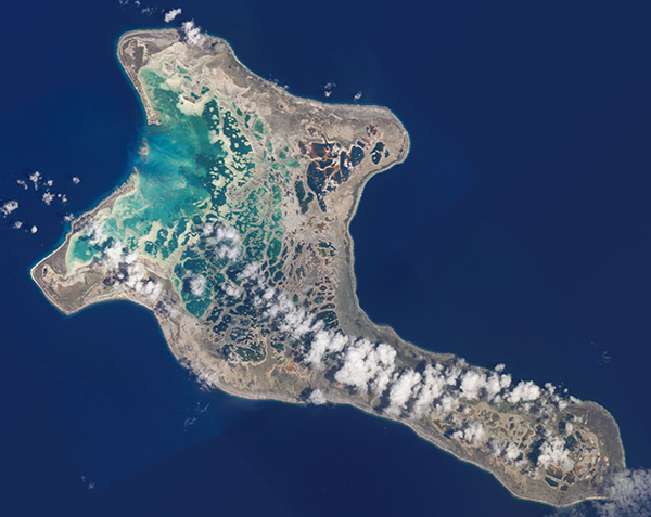
Twice-a-day weather balloons are being launched from Kiritimati (Christmas) Island through March.
Posted: February 5, 2016