'Micro-Satellites' will use GPS signals to study hurricanes
Launch scheduled for December 12th
The same GPS technology that helps people get where they're going in a car will soon be used in space to improve hurricane forecasting. In the past decade, there has been considerable interest in using existing manmade electromagnetic signals, such as GPS, to provide information about ocean surface wind speed, soil moisture, or snow accumulation. On December 12, NASA will launch a set of identical "micro-satellites," which will use this technology to measure wind speeds over Earth's oceans and enable scientists to better understand and predict hurricanes.
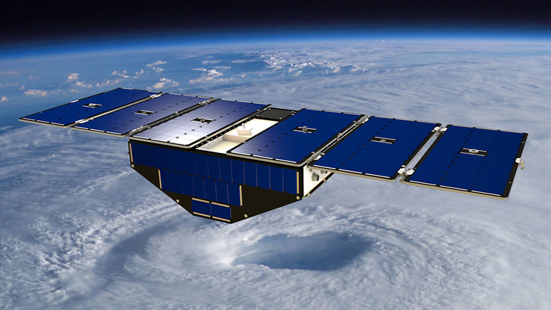
The eight identical satellites being launched will fly in formation to measure wind intensity over the ocean. This novel approach uses reflections from GPS [more widely known as Global Navigation Satellite System (GNSS)] signals off the ocean surface to monitor surface winds and air-sea interactions in rapidly evolving cyclones, hurricanes, and typhoons throughout the tropics. The satellites in this Earth science small satellite constellation, called the Cyclone Global Navigation Satellite System (CYGNSS), will receive information based on signals from four GPS satellites. Physical Sciences Division researcher Valery Zavorotny is part of a science team providing expertise for various parts of the mission. He has contributed guidance on how to measure and interpret the GPS signals into meaningful data that can be then be used by meteorologists.
"I am excited to participate in the CYGNSS mission, and I hope that we will get new and useful data about winds and waves generated by hurricanes," said Zavorotny. A physicist specializing in modeling of electromagnetic wave scattering from ocean waves, Zavorotny has spent time in recent years investigating how GNSS "signals of opportunity" reflected from the ocean and terrain can fill gaps in existing observing systems. This technique became known as GNSS reflectometry.
"We are witnessing now how this novel remote sensing technique is coming out of its infancy and heading toward a more mature state," said Zavorotny. "There are a number of challenges ahead that need to be addressed, but a vision for GNSS reflectometry looks promising. It can nicely complement existing radar and radiometer remote sensing, and in some situations can provide unique opportunities and capabilities that cannot be achieved by existing traditional remote sensing tools."
The launch will take place at Cape Canaveral Air Force Station in Florida.
Partners Include: University of Michigan, NASA, NOAA (NESDIS, OAR/ESRL, OAR/AOML), Southwest Research Institute, Surrey Satellite Technology
Posted: December 7, 2016
- Related Websites
- University of Michigan CYGNSS Page
- NASA CYGNSS Page
- Remote sensing using GPS