"Perfect Model" Evaluation of Statistical Downscaling Methods ESTCP Atlas of Results for CONUS
 |  |
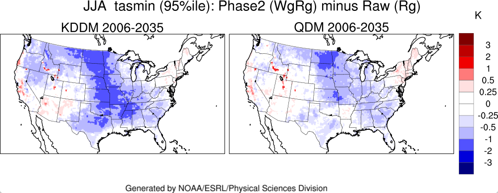
Downscaling methods are evaluated using the "perfect model" framework, where one model is treated "as if" it were the truth, both in the present and in the future. The evaluation is done in two phases reflecting two fundamental features underlying many empirical statistical downscaling -- bias correction, and change of spatial scale.
Phase Descriptions
- Maps for CONUS that evaluates accuracy of downscaling in a single "unbiased" model framework, where a coarse-grained version of a single model is used to predict its own fine structure.
- Maps for CONUS that evaluate the accuracy of bias correction without downscaling by "cross-training" between two models at the same spatial scale, one of which is considered the "truth".
User Guide: How to use and interpret the atlas.
Features
Evaluation of three downscaling methods:
- KDDM -- Kernel Density Downscaling Method
- QDM -- Quantile Delta Method
- TD -- Transient Delta
Three climate variables :
- Tasmax -- Daily Maximum Temperature
- Tasmin -- Daily Minimum Temperature
- Pr -- Daily Precipitation (Pr is not available for the KDDM method)
Four Time Periods
- Historical (1976-2005)
- 2006-2035
- 2036-2065
- 2066-2095
Evaluation metrics:
- Seasonal mean (DJF, MAM, JJA, SON)
- Extremes (1st, 5th 95th and 99th percentiles)
- Kolmogorov-Smirnov test for difference of probability distribution
Multiple GCM/RCM models:
- Six GCM/RCM combinations (Phase I)
- Two GCM/RCM combinations (Phase II)
Data for plots
- To cite plots "Image provided by the NOAA-ESRL Physical Sciences Laboratory, Boulder Colorado from their Web site at https://psl.noaa.gov/models/estcp/"
- If you are interested in the data, please contact Keith Dixon at NOAA/GFDL
Funding
This work funded by the Department of Defense Environmental Security Technology Certification Program (ESTCP) and performed by NOAA Earth System Research Lab Physical Sciences Laboratory (PSL) in collaboration with the National Center for Atmospheric Research and the NOAA Geophysical Fluid Dynamics Laboratory.

This is a Research and Development Application
Page Last Reviewed: May 10, 2024