NOAA Hurricane Hunter to Measure Sea Spray
Data from new onboard droplet-sensing radar may help improve hurricane forecasts
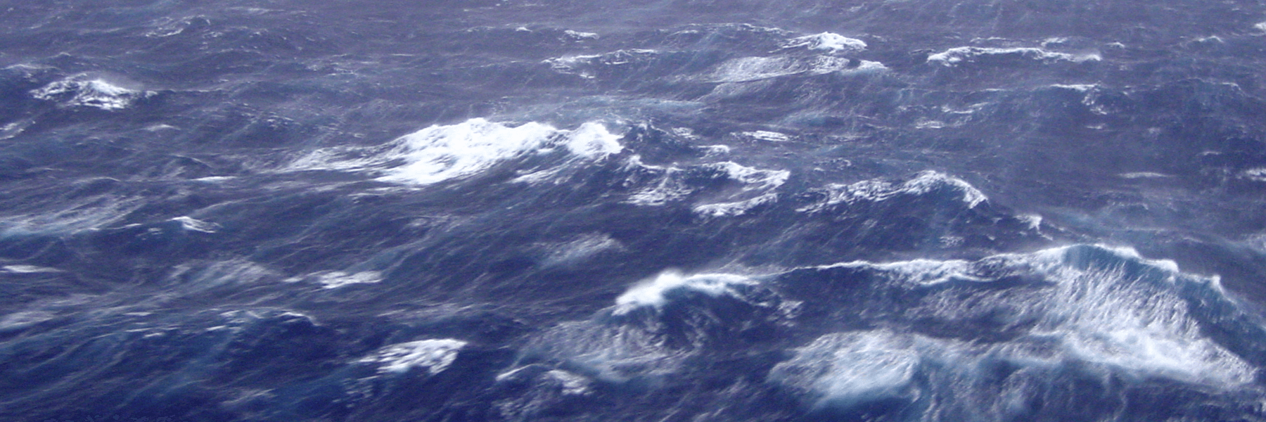
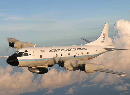
Weather forecast models have become a critical tool for saving lives by helping to predict where and how hard a hurricane will hit the coast. Although NOAA continually researches ways to improve these models, there are some types of useful information we haven't been able to include yet. Scientists have theorized for some time now that the exchange of heat (called the heat flux) between the ocean and the atmosphere may affect a hurricane's path and strength. Although methods to measure heat fluxes have been developed, a mysterious 'intruder' mixes into the air in a shallow layer over the ocean (within 100m of the ocean surface), which affects the process. This culprit is sea spray. We know hurricanes generate a lot of sea spray but we don't know how much and a way to accurately measure it has eluded researchers. In fact, a theoretical model has been developed of how a specified amount of sea spray affects the heat transfers over the ocean – but researchers just don't know how much sea spray to specify! The answer may be in a newly reconfigured cloud-measuring radar developed at ESRL's Physical Sciences Laboratory (PSL), which is ready to fly this season aboard the NOAA P-3 aircraft (aka 'Hurricane Hunter').
During the past two decades, PSL has been measuring the ocean-atmosphere heat flux around the globe using a ship-based instrument cluster called the Air-Sea Flux System. It was during the development of this observing system that the question evolved of how sea-spray heat fluxes might impact hurricanes. Observations of heat fluxes and sea spray from ships have shown that the amount of spray increases rapidly with windspeed. The mass of sea spray generated increases roughly as wind speed to the 3rd power. However, for practical reasons (safety and wear/tear on sensors), high quality flux and spray observations from research vessels are restricted to a wind speed limit of about 55 mph.
Getting real measurements of sea spray at hurricane wind speeds has confounded researchers for some time. One idea was to install instruments on buoys. But the expense and figuring out how to position the buoy in the immediate path of a hurricane makes that approach impractical. Another idea tested in the early 2000s, was to collect the data from a low-flying research aircraft during a hurricane. Initial trials found that this method was too dangerous because sea spray got into the engines and could cause them to fail. However, the idea of using a sea spray sensing radar mounted on an aircraft was born. NOAA P-3's routinely fly into hurricanes and a look-down, shoot-down Doppler radar will permit observations of spray profile properties from the (relative) safety of a few thousand feet altitude. Unfortunately conventional radars are not sensitive enough to detect the relatively small (0.1 mm) sea spray droplets.
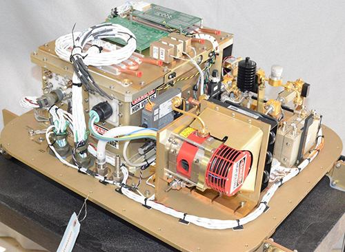
Engineer Ken Moran (PSL and CU-CIRES) led a team in 2005 to build a highly sensitive radar, called the W-Band, which is used to detect small water droplets. The term W-Band refers to the frequency band in which the radar operates, 95 giga-Hertz (GHz). This type of radar is also termed a millimeter=wavelength radar because the wavelength of the electromagnetic energy that is used to detect droplets is about 3 millimeters. This small wavelength allows the radar to "see" very small objects; in this case, spherical water droplets. Weather radars that most people see on their local weather channel use longer wavelengths, typically 10 cm, and can detect only large precipitation drops in rain clouds. The W-Band radars can provide sensitive measurements in clouds that contain very small water droplets of fog or mist. The ESRL W-Band radar has been used on research vessels to look up at the clouds that develop over the ocean on several programs that study the energy flux near the ocean surface. Since its development, the W-Band has successfully collected data for numerous experiments aboard reseach ships in the South Pacific, the North Pacific, and the Indian Ocean.
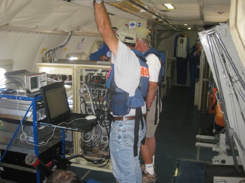
Because the W-Band was originally fitted for ship-based experiments, it was an awkward package to fit on an aircraft where space and ruggedness are at a premium. So the radar was deconstructed and then repackaged for use on an airplane. The aircraft version was ready earlier this year, and lead engineers Moran and Sergio Pezoa (PSL) performed the final fitting and installation on a NOAA P3 this summer. A successful test flight was flown in late July.
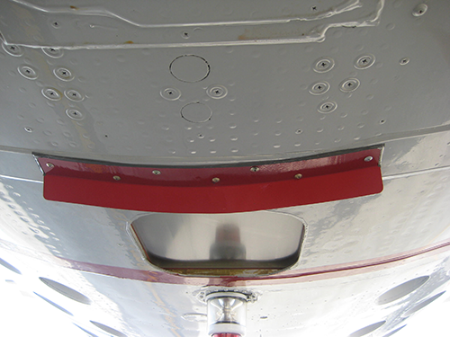
The radar is housed in the belly of the P3 aircraft and looks down through a thick radar-transparent window at the sea surface below. The echo from the surface is very strong and one issue during the test flight was whether the echo would be too strong.
"We were worried about the intense brightness of the ocean surface interfering with our ability to see the sea spray," said lead researcher Chris Fairall of PSL. "But the contamination of the signal by the surface return seen during the test flight disappeared almost immediately, and the radar was able to see from 50 meters up."
They were also able to use the intensity of the surface return to verify the operation and calibration of the radar.
"These early test results provide us with confidence that we can make sea spray observations near the surface up to several thousand feet if storm conditions are right," said Moran.
The W-Band Radar is ready and waiting to be flown during the the Fall 2013 hurricane season. The goal of the first flights into a tropical storm will be to detect sea spray near the surface and hopefully distiguish it from any rain drops that are in the vicinity. With luck the radar will be able to measure sea spray droplets in a column up to a thousand feet or more to provide the first look at where sea spray is active.
"In this first season of its use, we hope the W-Band will operate successfully in several storms. Given the almost complete lack of information on sea spray, almost any hurricane is likely to yield valuable information," said Fairall.
By Barb DeLuisi, Fall 2013
More Images